Driving through a bomb cyclone in full fury is not fun but it sure is lovely. Join Fluffy and me for the last leg of our epic road trip where we power through a lot of snow in Oregon, play tourist in Seattle, Washington and Vancouver, B.C. After getting a bit lost, we make it to the Pacific Rim National Park on Vancouver Island and finally make the long journey home, stopping at some lovely hot springs and visiting the Spiral Jetty and Sun Tunnels in the Utah desert.
Tag: Wyoming
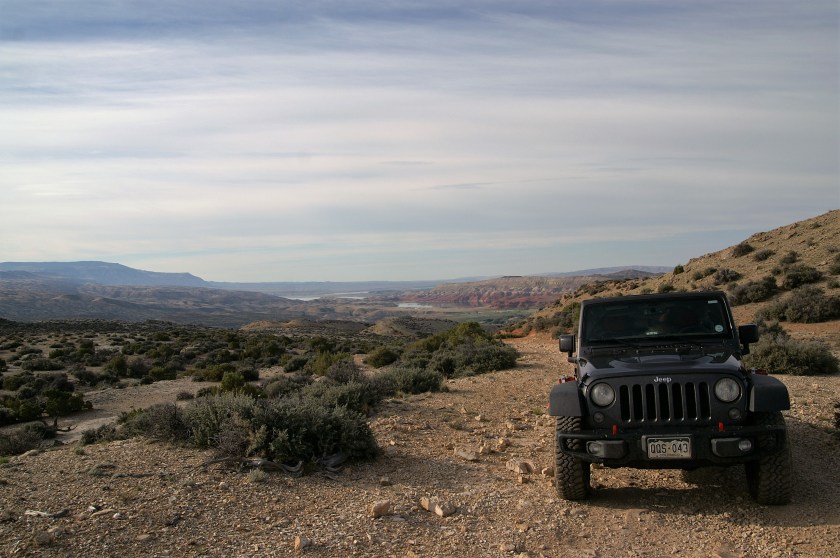
Solo Wyoming Road Trip
Hey Folks! Just added another video of an 8 day Wyoming Road Trip Fluffy and I took in July. It’s a long one, but there was a lot of ground to cover! We visited one of my favorite places in Wyoming, called Adobetown and tackled the iconic Morrison Jeep Trail. Enjoy!
All The Pretty Horses

In a remote region of Northern Wyoming and Southern Montana, the Pyror Mountain feral horse herd roams free over vast high mountain meadows. The Pryor Mountain Wild Horse Range is one of those very special places where it feels like your soul has found home. I first visited this area in 2003, then again in 2004. A return visit had been on my mind for a while and I finally had the opportunity to visit my old friends again last week.
At the top of the mountain, the views of the Big Horn Canyon and surrounding public lands are stunning, but the horses are the main attraction. The Pryor mustangs tend to be small in stature and many have primitive markings such as dorsal stripes and zebra striping on their legs. They are accustomed to gawking humans and their inquisitive nature often leads to close encounters.

Several local groups (along with the BLM that manages the herd) keep close track of the herd, including naming each newborn foal and keeping track of lineages and deaths. The most famous of the horses is White Cloud, a pale palomino stallion that stands out for his unique coloration.

On my first visit to the range, in 2003, I had the mountain top and horses to myself. It has since become a more popular destination, but there are still plenty of opportunities for alone time with the horses. The bulk of the human visitors only come up for the day, so if you camp out overnight, you’ll find more solitude. There are several good locations for dispersed camping on top of the mountain. If you’re lucky, a few of the horses will come over to check out your tent.
There are three roads that access the mountain range, Pryor Mountain Road (aka Sage Creek Road), Burnt Timber Ridge Road and Sykes Ridge Road. I have driven all three on different trips to the area. The Pryor Mountain Road is a (mostly) well-maintained gravel road that is passable by passenger cars, but it does get a bit bumpy over the last few miles. Burnt Timber and Sykes Ridge are 4WD roads. Burnt Timber is a bit easier on the suspension than Sykes. Keep your eyes peeled on both roads for horses grazing at lower elevations.

Sykes Ridge Road was the first real 4WD road I ever drove and it can take a toll on your vehicle. On my first trip up Sykes in my old pick-up truck, I managed to blow out a sidewall on one of my tires, destroyed my power steering gear box and seriously damaged my alignment. It’s not a road to travel unprepared. It is 16 miles of very rough road and a high clearance 4WD vehicle is required. While it doesn’t have any particularly dangerous sections, there are stair-step and rock garden obstacles along with steep, rocky ascents that will require use of 4-low and your skid plates will likely takes some hits. This trip, my trusty Jeep made it just fine. Whichever road you chose, take a good map.

This is a place that is better described in photos than words, so on with the show!


For more information about the Pryor Mountain Mustangs check out:
KBRHorse.net has directions for getting there, but still take a good map, the directions are a little off.
Wild In The Pryors Nice blog from a gal that takes people on tours of the mountain.
BLM Website but, don’t rely on their maps to get there!
Happy trails!
Katie
My Happy Place…

My happy place lies in the heart of the Red Desert. It’s a seemingly barren wasteland that stretches across south-central Wyoming. The largest geologic feature is Great Divide Basin, the only place where the continental divide splits in two and the scant amount of water that lands in the basin evaporates before ever finding its way to a river. It’s a lonely place, largely inaccessible by vehicle. Millions of people whiz by it on the freeway, never dreaming of the wonders hidden behind the sagebrush. It’s a place for wandering (trails are almost non-existant) and for being alone, truly alone. There isn’t a speck of civilization for 50 miles. Once the yips and howls of the coyotes die down for the night, it is utterly silent. It’s a place to recharge your soul.

Hoodoo formations in Adobetown

Wind and water sculpt the landscape in Adobetown.
The days are blistering hot and the wind blows constantly and hard enough to knock you off your path. The nights are calm and frigid. There are rattlesnakes everywhere you step. There isn’t a drop of drinkable water. The bentonite soil and large patches of quicksand make driving around hazardous in dry conditions and impossible if there is rain. It’s my patch of heaven. I spend the days hiking down arroyos and over sagebrush covered dunes. I explore the maze of canyons and wander through valleys of goblins and hoodoos.

A raptors nest sits atop a formation

Goblins abound in Adobetown

Adobetown vista
Life overcomes adversity here. Hardy desert flowers bloom in dry alkaline soil. Pronghorns and feral horses thrive on tough grasses and bad water. Raptors circle endless miles of barren land for a meal. The coyotes are legion. At night you can see more stars than you can imagine and peer into the depths of the universe. On a moonless night, you can see the Milky Way stretching across the sky. It’s my happy place. It’s tough to come home…

Feral horse herd in Adobetown

Feral Horse in Adobetown

Feral horse in Adobetown
Want to learn more? Check out these links:
Backpacker Magazine Article on Adobetown

Happy Trails!
Katie