Join us as Fluffy Dog and I embark on an epic road trip. Part one – Solo Backpacking Paria Canyon in Arizona and Utah.
Is it really considered a “Road Trip” if the first 6 days are spent backpacking? I’m not sure, but that’s what I’m going with anyway. I worked crazy hard with lots of extra shifts all summer to get an unprecedented 30 days off of work in a row! Fluffy Dog and I decided to use those 30 days for some adventure. In part one, we head to Arizona and Utah to hike the incomparable Paria Canyon. It’s 38 miles of adventure from the White House Trailhead to Lee’s Ferry!
Stay tuned and subscribe to our YouTube channel, ’cause there’s lots more to come and I’m furiously editing the next installment right now.
8 day motorized raft trip down the Grand Canyon and the Colorado River.
It’s been a long time coming! Grab some popcorn and settle in for our latest adventure video! It’s a whopping 1 hour and 7 minutes of me talking about the toilet system, plus miles of Grand Canyon awesomeness!
It’s hot. It’s dusty. It’s amazing! We have piles of laundry waiting, dust on everything and need to catch up on days of sleep, but part of decompression is sharing our experiences. On that note, I’ve been procrastinating the unpacking and instead created this video for all of you!
Hiking guide to the Geneva Creek Iron Fens, Clear Creek County, Colorado.
Tucked away a short hike off of a four-wheel drive road in the Guanella Pass area lies the Geneva Creek Iron Fens. A rare geologic phenomenon unique to Colorado, iron fens are formed when mineral rich groundwater bubbles up from mountain springs and forms colorful ledges and terraces composed of limonite (the earth pigment used to create ochre dyes). Iron fens also produce acidic peat-forming wetlands that supports rare plant communities, including the only known occurrence of Sphagnum girgensohnii (a sphagnum moss) in Colorado. The hike to Geneva Creek Iron Fens is short, but allow plenty of time to explore the fens and the surrounding areas.
Features: Unique geologic process, rare plant community, designated Colorado Natural Area (Colorado Parks and Wildlife), historic mining buildings Location: Guanella Pass Area, Geneva Creek Basin Maps: National Geographic Trails Illustrated Map 104: Idaho Springs, Loveland Pass; USGS 7.5′ Montezuma, CO Managing Agency: Clear Creek County Open Space Commission Emergency Contact: Clear Creek Sheriff 303-679-2376. Cell reception is non-existent in this area. Carrying an emergency GPS beacon is recommended.
Distance: 2.4 miles round-trip Time: 2-4 hours Difficulty: Easy to Moderate. The distance is short, but it is at high elevation. Rating: Class I. Easy hiking on a good trail. The footing is generally good when exploring the fens, but can be slick in spots and if you venture into the swampier areas, be cautious of stepping in deep, wet mud. Starting Elevation: 10800 feet Ending Elevation: 11400 Elevation gain: 600 feet
Permit: Not required Vehicle Access: Four-wheel drive is required to reach the trail head. High clearance is recommended. Gear: Waterproof boots are recommended. Water: Bring at least 1 liter. There is abundant water, but it may be contaminated with heavy metals. Dogs: Dogs are permitted. Keep under control to protect wildlife, livestock and fragile environment. Season: Late Summer, Early Fall. The access road (FR119) is closed by snow in early to mid-October until late July. The trail is accessible in winter by skis or snowshoes but much of the winter the closest starting point will be the Duck Creek Picnic ground at the head of FR119 which will add 7 miles each way. Camping: Geneva Park Campground (National Forest Service Fee Site) offering tent and RV camping is near the start of FR119. Many free dispersed sites are available along FR119. Duck Lake Picnic area is also near the start of FR119 for day use only. Restrooms: None Food:Al’s Pits in Grant, Colorado provides great BBQ. For a hearty lunch or breakfast, check out The Shaggy Sheep. Nearby: Geneva Basin mining area (requires high clearance 4wd), Shelf Lake Trail, Jackwhacker Gulch, three 13,000+ foot peaks (Landslide Peak , Geneva Peak, Sullivan Mountain), and Josephine lake (the most Northern Lake in the county).
Directions to the Trailhead: From Denver:
1. Travel south on Highway 285 to the town of Grant located about 40 miles South of the C-470/Hwy 285 intersection (45 minutes)
2. Turn right on Park County Road 62 (Geneva Road/Guanella Pass) and continue for approximately 7 miles (15 minutes)
3. Turn left at Forest Road 119 (four-wheel drive only) and arrive at trailhead after 5 miles (30 minutes) Driving Notes: FR119 is a four-wheel drive road that starts off as a graded road, but becomes rougher and narrower the farther you go. Be prepared for large puddles, stream crossings and lots of rocks. At 4.3 miles, you will pass through private property. At 5 miles cross Jackwacker creek. The trailhead is on the left just 0.1 miles beyond the creek crossing (5.1 miles total) and only has room for one or two vehicles. If you are unsure if your vehicle can do the creek crossing, there is a wide spot suitable for parking two or three vehicles just before you reach the creek. Beyond the trailhead, the road becomes a narrow shelf road with a steep grade and is only suitable for high clearance 4wd vehicles and experienced off road drivers.
Trail Description: The trail is an old 4wd road making it wide and easy to navigate. Distances are approximate.
0.0 Mile – Walk in past the locked vehicle gate 0.5 Miles – Cross a shallow pond by rock hopping or walking through the shallow water. The trail starts to climb after this crossing. 1 Mile – Unsigned fork in the road. Take the right fork. The left fork leads to another fen that is also worth exploring if you have time. 1.25 Miles – Arrive at the Iron Fens. Explore the Fens as long as you like before returning the same way you came.
Trailhead Parking. If you continue up the road to the right, it quickly becomes a steep, rocky, narrow shelf road, suitable only for high clearance 4wd vehicles with experienced off-road drivers.Vehicle barricade at the start of the trailThe pond crossing at 0.5 miles requires some rock-hopping.The road forks at about mile 1.0. Take the right (lower) fork to reach the fens.Arrive at the fens at about mile 1.4 and spend some time exploring.
Check out these videos we made at the fens. The first one was starting at a different, less accessible trailhead. It’s about a mile up the high-clearance 4wd road and requires some off-trail navigation.
and this one too!
We would love your feedback! Did you find the guide useful? Would you like more information in a trail guide? Did you get hopelessly lost following our directions? Let us know in the comments!
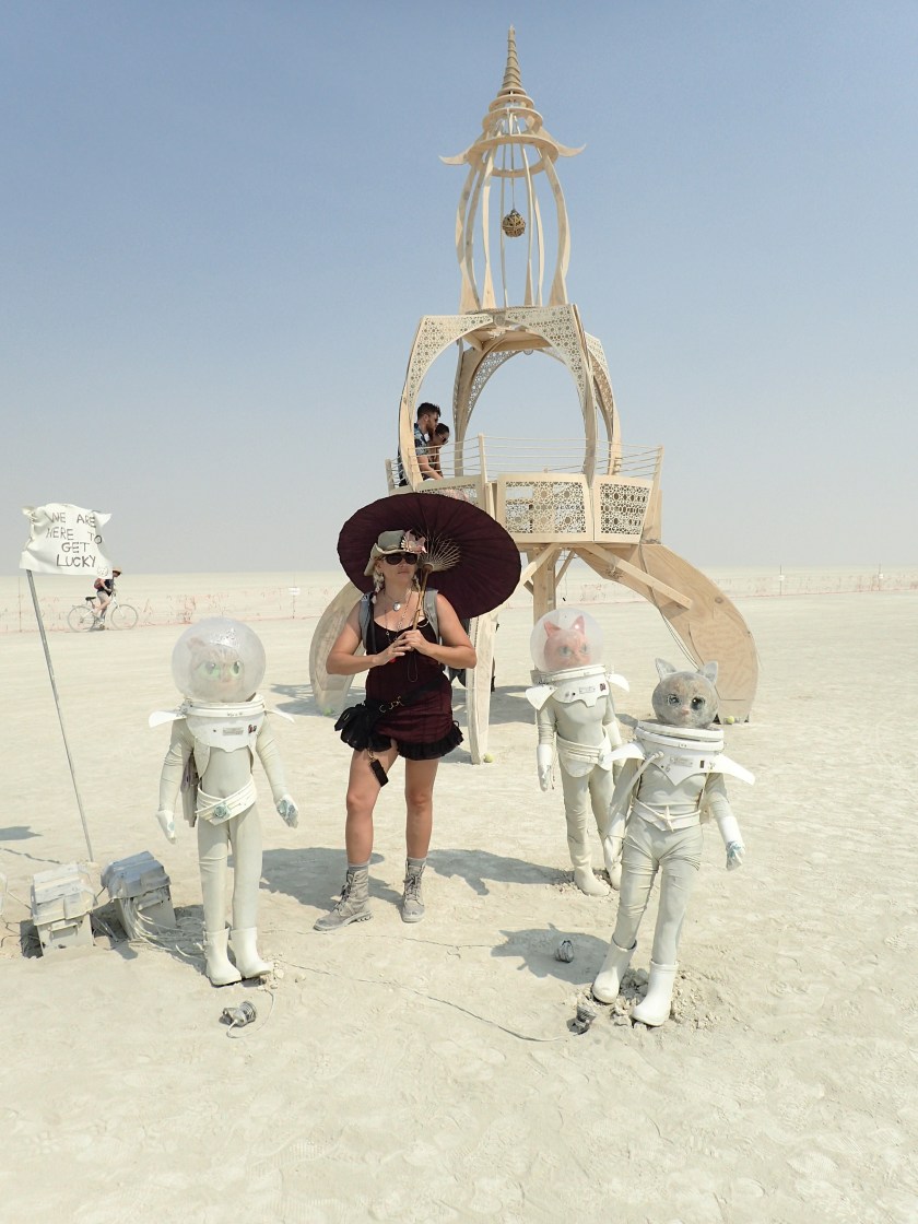
Every year, during the blazing heat of summer, a group of artists and misfits gather in the scorching Nevada desert for a week-long celebration of community, humanity and art. They call it Burning Man.
The Man
Every year, during the blazing heat of summer, a group of artists and misfits gather in the scorching Nevada desert for a week-long celebration of community, humanity and art. They call it Burning Man and it’s part social experiment, part art extravaganza and part joyous display of the human spirit. Thousands of dreamers and doers pour their heart and soul into building a magical, ephemeral place called Black Rock City. During Burning Man, a fully functioning city rises out of the barren playa and after one amazing week, it disappears back into the dust.
Loved these twin Hexayurts way out in the open camping area.
I’d heard of Burning Man here and there over the years, but had never known anyone who had actually been there. My uninformed impression was that it was some sort of Bacchanalia for drugged out hippies and EDM kids. In truth, hippies and EDM fans do make up a part of the population, and plenty of people indulge in mind altering substances, but the bulk of the population is composed everyday misfits like myself who are just there to (hopefully) contribute to the city and be amazed by the contributions of others.
Our decision to go to Burning Man was made on a bit of a whim. We’d seen the pictures of the art and the outfits, but had no concept of what it really is. Being outdoor girls who don’t want to die, we live by the motto of “be prepared.” So months before the Burn itself, the research began. Like the prep for any adventure, we researched the location, the logistics (getting a ticket, food, water, shelter) and the culture. Yes, culture. Burning Man has it’s own rules, communities, lingo and social mores. We read blogs and watched videos, and joined Burning Man social media groups. We even built a playa-tested shade structure based on some vague (but ultimately successful) plans we found on the internet. We were ready.
Our Tensigrity Shade Structure worked quite well on the playa and it can hold 3 hammocks!
The more I researched, the more I came to understand that Burning Man is not just a bunch of people partying in the desert surrounded by cool art, but I didn’t truly understand what it is. Once I actually arrived I realized I couldn’t know exactly what it is beforehand, because you have to actually go there to really get what it’s all about. That’s why burners have a hard time explaining it to non-burners. Burning Man is whatever you want it to be, it’s what you make it and it’s what you need it to be. I can show you pictures of what we saw and tell you what we did but I can’t tell you how it feels, except that it feels amazing.
Yours Truly, feeling amazing!
It also feels hot. Burning Man takes place in a desert. In August. And it’s hot. Really hot. Large portions of our days were spent trying to cool off and keep hydrated. Misters and spray bottles of water were lifesavers. We spent a couple of days thinking we were being kind of wimpy about the heat until we learned that it was the hottest year on record for Burning Man. Misting camps and shade structures were very popular hangouts this year. All that heat did have an upside. There was only one major dust storm all week and the nights were pleasantly cool.
We looked forward to the sunsets every night because it cooled off enough to go exploring.
You hear lots of warnings about the dust. We took them seriously. The playa is an ancient lake bed and the “soil” is composed of a very fine alkaline clay. It’s similar to bentonite clays we often encounter in Western deserts, but it’s much finer. It is composed largely of decomposed volcanic rock and has the consistency of baby powder when dry. The slightest breeze makes it airborne and it subsequently gets everywhere and sticks to everything. When wet, it turns into a slippery, tire swallowing hazard. We taped up our trailer windows with reflectix, we kept the truck doors closed and only ran the A/C on recirculating, we had a mandatory footwash before entering the trailer. Our efforts paid off with minimal clean up needed when we returned the trailer to the rental place.
Waiting for sunrise out by the trash fence.
During any adventure, there’s always a point where you find yourself hot, tired and maybe a bit grouchy. Burning Man is no different, but just when you think you’ve reached a low, something wonderful happens. It might be something small, like the gift of a hot dog when you just noticed you were hungry or something big like an art car comes passing by and offers you a ride. For me the highlights include being gifted an airplane ride over the city, waking up before sunrise and biking out to the trash fence to watch the day begin, an impromptu picnic of deconstructed Spam sushi we stumbled upon in the deep playa, listening to a live opera singer performing on a giant, house-sized gramophone, and pushing my own personal boundaries at the Human Carcass Wash.
Marybeth hanging out with the Space Cats in the Deep Playa.
Hosted by PolyParadise, the Human Carcass Wash is one of the more unique experiences on the Playa. If you’re feeling kinda dusty and gross, head over to the Carcass Wash. Leave your clothes at your bike and queue up with 50 or so other naked people to wait your turn to wash and be washed. Yep, it’s a little weird at first hanging out in the buff, chatting with other naked people, but it quickly starts to feel normal. The wash is set up a bit like a car wash with stations for soaping up, washing, rinsing and a final squeegee. The washing is done by the participants and monitored by camp members that give instructions, keep the line moving, and diplomatically and gently deal with people who are having a hard time with exploring their own boundaries or those that need help understanding the boundaries of others. There’s not a “girls only” or “boys only” line. It’s one “humans only” line. Male, female, gay, straight, fat, thin, able bodied, disabled, pretty and not. Everyone is welcome. Everyone is accepted. Everyone ends up a little cleaner than they started.
Hanging out beyond the trash fence at the Black Rock City Airport.
With so many sights and activities to capture your attention, it’s impossible to do it all, but one of my goals at Burning Man was to see it all from the air. There are three ways to get a plane ride at Burning man: hope the skydiver camp has extra spots on their plane, wake up really early to get your name on a list for a tourist flight (which may or may not happen), or know a pilot. The first two require a bit of luck and a long wait. Luckily, one of Marybeths old friends (“Captain Kirk”) is a pilot, though even with an “in” our flight almost didn’t happen due to a series of unfortunate events. The first delay happened when the runway was shut down after a pilot failed to deploy his landing gear. Oops. That got cleared up just in time for a dust storm. Low visibility grounded all the flights for a few hours. Just when it was looking like we were good to go, another pilot forgot to secure his storage compartment on take off and littered the runway with luggage. We ended up being the last flight out of the day and it was worth the wait! We also discovered the best kept secret of the playa. The porta-potties at the airport, beyond the trash fence are immaculate! It’s the little things that count the most.
The Man Burning
Burning Man is a temporary, place. Many of the large scale artworks, including “The Man” are built to be ultimately burned to the ground. On Burn Night, the Art Cars line up encircling the structure and people on foot (nearly the whole 70,000 who attend) fill in the space up to the burn perimeter. The Burning of the Man is an amazing spectacle, one I didn’t think would leave me in awe, but it did. The lights, the sounds, the people, the hundreds of fire dancers, the fireworks, and the intensity of the burn all contribute to the experience. It’s fun and absurd. It’s peaceful and exciting. It’s sacred and profane. I can’t really explain it. You just need to go.
With all the grand spectacles at Burning Man, what’s really amazing are the little things you find in your own neighborhood. The local coffee shop, the Pirate Bar around the corner, chatting with your new neighbors and passersby about the wonders they’ve seen, and getting a hug, a smile and acceptance from just about everyone you meet.
I can’t wait to go back!
Happy Trails,
Katie
Katie headed across the Playa.This is a big part of what it’s all about.The Angler Fish Art Car.Marybeth and Momma Bear.No words. This is simply beautiful.Marybeth and the Temple.Black Rock City from the Air.The A-Roar-Har gals.Every Burgin must roll in the dust and ring the bell!Don’t think she has to worry about the dust getting washed off.Well, Hello There!Sunrise with a pal.
We’ve had a lot of adventures this summer, but the highlight has to be the one we just returned from…Burning Man! A blog post is in the works, but enjoy this video we made in the meantime!
Enjoying the surf, sand and sun at North Beach on Isla Mujeres.
The last time I traveled to Mexico, I was 18 years old (yes, that was a loooong time ago). I traversed the border with my college boyfriend at San Diego to have some drinks and take in the sights of Tijuana. My short visit did not really leave the best impression. The things that stick in my brain from that adventure are the extreme poverty, destitute children selling chiclets, places advertising donkey sex shows and street after street of hawkers selling crappy tourist merchandise for “almost free.” Almost free was way beyond my college budget, so I didn’t bring anything home and even tequila bars were a stretch. This time, a little more luxury and a quiet beach town was on the agenda.
Our first sunset on the beach at Playa Lancheros.
Our parents, those adventurous folks who inspire us to be the itinerants that we are, wanted a family vacation to bring together our far flung siblings and nieces. As our parents are aging, and we are realizing that the time we have left with them is shorter than the time we’ve already had, it has become a priority in our lives to spend more time with them. On Marybeths suggestion, we choose Isla Mujeres, a cute caribbean island just off the coast of Cancun on the Yucatan peninsula. She had been there a couple of times previously with friends and knew it would be just thing for a family get together.
The island is awash in tropical colors.
This bike is so rusty, it’s a wonder that it’s still rideable.
My prep work for this trip consisted of trying to fit back in my swimming suit after half a winters worth of putting on winter weight and finding my passport and towel. In general, we relied on Marybeth to get most of the plans together (which she did), but also, this part of Mexico is so practiced at catering to tourists, particularly American tourists, little preparation is needed. Which is the problem. Isla is a a cute little place, with lovely beaches, good food and plenty of sun, but it hardly feels like you’ve left the country. It’s a little difficult to wax poetic about a place that’s not very different from the Florida coast where we grew up. I actually like a little struggle with the my travel and I enjoy getting pushed out of my comfort zones. That’s possible here, but you have to try really hard and with poolside drinks just waiting for you it’s difficult to get the motivation.
Two iguanas basking on the rocks at Punta Sur.One of the many large steel artworks in the sculpture garden at Punta Sur.The ruins of Ixchels temple on Punta Sur.
This part of Mexico is, however, a great place for family and for newby international travelers. It’s easy to get around the island. Most of our transportation was provided via rented golf carts, though we used the ubiquitous (and cheap) taxis on a number of occasions. Zipping around the Isla on golf carts is great fun. Just keep an eye out for one-way roads and the many speed bumps peppered over the island roads. Take some time to just explore the island, it would be pretty hard to get truly lost. Do go visit the Ixchel temple at Punta Sur. It’s a lovely spot. Take the short trail down and around the cliffs, but watch your step wherever you see wet pathways (I almost ended up a mermaid after slipping on on some of it).
While all the food we had on the Isla was phenomenal, the gold star goes to a tiny, humble restaurant called El Charco for the best Flautas I’ve ever had!
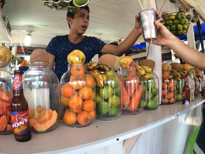
English is widely spoken by those working in the tourist trades and most restaurants have menus in English and Spanish. On the topic of food, you would have to work pretty hard to find a bad restaurant here. Everywhere we ate was good, a few fantastic. Fresh seafood and fresh pressed juices are not to be missed. Many of the restaurants along the coastlines are co-ops run by fishermen who bring their fresh catches in daily. Living in landlocked Colorado, truly good, fresh seafood is a luxury commodity in which I rarely indulge. On the Isla however, seafoods are cheap and plentiful so I ate to my hearts content!
Mayan Temple at Chichen Itza, miraculously devoid of crowds.If you were a fitting sacrafice in ancient Mayan culture…this is where you would die.These columns were roofed with wood in ancient time to provide shade for Mayan pilgrims.Swimming in Cenote Saamal.
We booked a driver with Carm Tours and Transfers and spent a day traveling to Chichen Itza. We got to Chichen Itza early in the day, well ahead of the crowds and heat of the day, so we were able to enjoy the park in relative peace. The ruins are truly impressive and well worth the long drive. After we had our fill of the park, our driver took us to Selva Maya Hacienda for a great lunch followed by swimming in the adjacent Cenote Saamal. Devoid of surface rivers, the Yucatan Peninsula has vast underground waterways. In some areas, the ground above the water gives way and forms cenotes. Bringing life sustaining water to the inhabitants of the peninsula, cenotes are magical places and swimming in a cenote is an experience not to be missed.
Marybeth and I logging dive time.
I was thrilled to have my first chance to go diving in over 20 years. I was PADI certified when I was 16 years old and for a couple years before going away to college, I spent quite a few weekends on dive trips in caverns and springs around Florida. It’s been a long, diveless time between then and now, so after a short “refresher” course, I was ready to go. Diving is a lot like riding a bike, what you need to know comes back to you pretty quick. Marybeth and I did two reef dives with the Squalo Adventures dive company. The water was clear and calm and we were treated to the wonders of the reefs including lots of fishes, lobsters, sea urchins, and even a stingray.
Yours truly, relaxing at North Beach.
Beaches and beach clubs are the highlight of any coastal Mexico vacation. Take your pick of venues and rent a chair or cabana to spend a relaxing day in the sand and sun. There are the usual vendors hawking goods on the beach, but they are rarely pushy and will move on with simple “No gracias.” Most of the beach clubs have waiters ready to bring you whatever food or drink you might like right to your cabana, or you can sip a Mojito in the shade in one of the many beachside bars.
A bittersweet sunset. It’s time to go home.
After nearly 10 days of surf and sun, coastal vibes and sumptuous seafood, it was time to go home. We are already dreaming and planning a return to Mexico. It’s a large, diverse and welcoming country and we want to sample it all!
“Is it safe to go there?” is the first question people asked when we said we were going to Colombia. When answered in the affirmative the next question from our genuinely baffled acquaintances was, “Why would you want to go to Colombia?” As lifelong itinerants our incredulous response is always, “Why the heck wouldn’t you go?”
Inglesia de San Pedro Claver in the Old City of Cartagena
Truthfully, I’ve had dreams and eventual plans of going many places in South America, but Colombia was never really on the short list. Opportunity arose to finally visit the South American continent when, bored of the usual stateside venues for my continuing education, I searched for something a little more exotic and found a veterinary conference that was being held in Cartagena, Colombia. The sum of my pre-travel knowledge of Colombia came from occasional news reports of the long-standing guerilla war and drug trafficking and what I gleaned from “Romancing the Stone” (which I discovered later was actually filmed in Mexico). We ordered a few travel guides (which we didn’t really use as none are very good for Cartagena), did some googling and watched an old episode of Anthony Bourdains travels to Colombia. In all, we weren’t terribly prepared, and having no real preconceived notions about the country and its people turned out to be a good thing. Cartagena is a city for wandering and discovering, not for planning and schedules.
Bougainvillea vines drape over many of the old Spanish buildings.
Cartagena is most of all a Spanish city. Like something out of a fairytale, its streets are graced with colorful colonial mansions dripping with bougainvilleas and grand old stone churches watch over every square. The old city is ringed by an imposing 7 mile long stone wall and the Castillo San Felipe de Barajas, a typical Spanish fort, served to protect the city from attack by land or sea. A port city settled and built by Spaniards in the 1500’s, Cartagena grew rich on the trading of gold and slaves. While the indigenous cultures were largely wiped out by the settlers and are a small minority today, the Palenqueras, those colorful ladies balancing bowls of fruit for sale on their heads, are descendants of escaped slaves and are a very visible reminder of the cities past.
Being a low lying equatorial city, it’s hot. So hot, the sweat starts streaming down your skin the moment you step outside into the tropical air. Part of that is because, though we grew up in humid swamp that is Florida, both of us are now cold-adapted mountain girls. The other reason, is that it’s just that stinking, crazy hot. As you wander the city, you find the heat is a little less brutal closer to the walls, with the inner areas harboring still, stagnant air. Tall buildings and narrow streets allow no trace of ocean breeze to pass. There is no relief from the heat until the afternoon wanes and the sun begins to set behind the city walls. It’s still hot, you’ll still sweat, and the ocean breezes are warm, but it’s far more comfortable than in the daytime. Sunset most often found us up on the walls of city, enjoying a cold cervesa from a street vendor and savoring the salty breeze.
By chance, we were in Cartagena for the signing of the peace agreement between FARC and the Colombian government. Ultimately, the people of Colombia voted against the agreement, but it was still a remarkable piece of history to witness. This was a candle-lighting ceremony in one of the city squares the night before the signing.
After dark, the city really comes alive. Too hot to be active during the day, the nightlife in Cartagena is robust with tourists and locals mingling in every square. Just follow the voices and music and you’ll find yourself being entertained by talented street performers or stumble upon a local bar where you can grab a cervasa and find the people of all ages salsa dancing. One of our favorite finds was the “Cuba 1940’s” bar where you can dangle you feet in a cool indoor pool while sipping Mojitos. Plaza de La Trinidad, in the Getsemani quarter, was steps from our hotel and swarming with people every night. Located in a working class neighborhood that is undergoing gentrification, and awash in expensive boutique hotels alongside hostels and modest local homes, a gathering of people from all walks of life occurs on the square. Grab some rum laced fruit punch from a street vendor and find a spot to sit and watch the show.
A wonderful way to spend the day and escape the heat on Isla Grande.
To escape the heat of the city, a trip to one of the many island beaches is in order. Though it’s a coastal town bounded by the ocean, the beaches near the city tend to be avoided by tourists, for good reason. Within moments of stepping onto a local beach you will be bombarded with people trying to rent you a cabana, or sell you a massage, jewelry, or questionable food. It never lets up and makes a peaceful day enjoying the surf impossible. Good thing there are lots of private or semi-private options on the islands off the coast. The charming hosts at our hotel, Casa Lola, set us up with a day trip to the beach at Eco-hotel Isla del Sol on Isla Grande. A privately owned resort, you get a boat ride to the resort, a hearty lunch and a peaceful day in the sun and sand. We also arranged a day at the Beach Hostel on Tierra Bomba, the closest beach to the mainland, accessed via a short 10 minute boat ride. It’s a laid back, casual atmosphere and there are a few peddlers offering their wares, but not so many to become a nuisance. I imagine that it might get pretty busy on the weekends, but we were there on a quiet weekday and enjoyed the beach with just a few other people.
Marybeth enjoying a relaxing day in her hammock at the Beach Hostel on Tierra Bomba.
While there certainly are American tourists, most of the tourists we encountered were from South America which means, few of the locals speak English other than what few words are needed to sell you stuff. It also means there are no Starbucks or McDonalds and when you speak as little Spanish as we do, it makes ordering food and getting information an interesting challenge. Most often, we would find a restaurant or food stand, and we would point to something that looked potentially tasty and say “Uno, por favor” to order. Eating mystery pastries and empanadas worked out pretty well most of the time.
Trying fresh fruit juices at the Mercado
From eyeballs to entrails, all manner of meat products are sold at the Mercado
An herb store at the Mercado
Our great lunch at the Mercado
Many varieties of exotic tropical fruits are for sale.
Fish monger at the Mercado
We hooked up with Cartagena Connections for their Street Food and Mercado Bazurto tours. The Mercado Bazurto is not on the agenda for your typical tourist, but it’s on our “don’t miss” list. A sprawling, dirty, bustling market, the Mercado Bazurto is an assault on the senses. Music is blasting from all corners as you navigate the maze. Sanitation is in short supply and the pungent sour odors of fish and meat, decaying vegetables, and piled trash are pervasive. Shopkeepers stalls are made from whatever materials could be cobbled together and roofed by old grain bags, netting and cardboard. The Mercado is the go to spot for locals to purchase just about anything you might need for your home or kitchen. Our guide, Jan, led us through the cacophony of sights and sounds and purchased some of the exotic tropical fruits and foods for us to sample. We shared a lunch of steamed plantain, deep fried fish and Aguapanela, a local drink made from sugar cane that tastes remarkably like Southern Sweet Tea. The intense heat of the day was made hotter by the blasts of heat coming from the cooking fires in that part of the market, but it was an experience not to be missed. We met up with Jan again later that afternoon for the Street Food tour, and got to try a variety of local foods along with learning a bit more about the layout and history of city. The arepas choclo were my favorite!
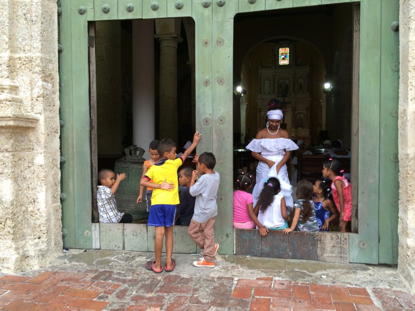
Local kids congregating at the church entrance during a wedding we happened by.
There is no shortage of things to do in Cartagena. Put on your shoes (and sun hat) and start wandering. Hungry? There are a myriad of restaurants and street foods to try. Want some culture? Several museums are located in the old city and are easy to find or book a tour to visit the village of Palenque (something I wish we had time to do). Hot? Head to the beaches. You don’t need to plan your time, just enjoy the city as it presents itself. In our wanderings, we encountered a fabulous parade of Colombian senior citizens, a neglected but beautiful cemetery (you need to wander a bit outside the city to find that one), and the warm, welcoming hospitality of people of Cartagena.
We are already dreaming of returning and expanding our travels beyond Cartagena. In the words of Anthony Bourdain, “It’s ludicrous that this place exists and everybody doesn’t want to live here.”
Happy Trails,
Katie and Marybeth
Some more photos from our adventure…
Marybeth relaxing at the rooftop pool of our hotel
Marybeth and I enjoying some beach time on Isla Grande
This is Maggy Luis who gave us an impromptu tour of Isla Grande
Vultures are all over the place.
Best ceviche in Cartagena
Two sloths live in the city park.
Trinidad square during the quiet of the day
Street Art is everywhere
A lot of street food is deliciously deep fried!
Guava paste and a local soft cheese from a street vendor
In a remote region of Northern Wyoming and Southern Montana, the Pyror Mountain feral horse herd roams free over vast high mountain meadows. The Pryor Mountain Wild Horse Range is one of those very special places where it feels like your soul has found home. I first visited this area in 2003, then again in 2004. A return visit had been on my mind for a while and I finally had the opportunity to visit my old friends again last week.
At the top of the mountain, the views of the Big Horn Canyon and surrounding public lands are stunning, but the horses are the main attraction. The Pryor mustangs tend to be small in stature and many have primitive markings such as dorsal stripes and zebra striping on their legs. They are accustomed to gawking humans and their inquisitive nature often leads to close encounters.
The foals are especially curious about humans. 2004
Several local groups (along with the BLM that manages the herd) keep close track of the herd, including naming each newborn foal and keeping track of lineages and deaths. The most famous of the horses is White Cloud, a pale palomino stallion that stands out for his unique coloration.
White Cloud and his harem, 2003
On my first visit to the range, in 2003, I had the mountain top and horses to myself. It has since become a more popular destination, but there are still plenty of opportunities for alone time with the horses. The bulk of the human visitors only come up for the day, so if you camp out overnight, you’ll find more solitude. There are several good locations for dispersed camping on top of the mountain. If you’re lucky, a few of the horses will come over to check out your tent.
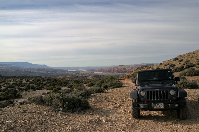
There are three roads that access the mountain range, Pryor Mountain Road (aka Sage Creek Road), Burnt Timber Ridge Road and Sykes Ridge Road. I have driven all three on different trips to the area. The Pryor Mountain Road is a (mostly) well-maintained gravel road that is passable by passenger cars, but it does get a bit bumpy over the last few miles. Burnt Timber and Sykes Ridge are 4WD roads. Burnt Timber is a bit easier on the suspension than Sykes. Keep your eyes peeled on both roads for horses grazing at lower elevations.
An old tractor lies at rest on Burnt Timber Ridge Road.
Sykes Ridge Road was the first real 4WD road I ever drove and it can take a toll on your vehicle. On my first trip up Sykes in my old pick-up truck, I managed to blow out a sidewall on one of my tires, destroyed my power steering gear box and seriously damaged my alignment. It’s not a road to travel unprepared. It is 16 miles of very rough road and a high clearance 4WD vehicle is required. While it doesn’t have any particularly dangerous sections, there are stair-step and rock garden obstacles along with steep, rocky ascents that will require use of 4-low and your skid plates will likely takes some hits. This trip, my trusty Jeep made it just fine. Whichever road you chose, take a good map.
They aren’t kidding about the 4×4 recommendation!
This is a place that is better described in photos than words, so on with the show!
Scratching an itch, 2003A stallion and his mare, 2003Hey friend! 2003A foal in a meadow of lupine, 2003Damage acquired on Sykes, 2003Overlooking Montana on the Pryor Mountain Road, 2004Mares and foals, 2004Just 3 little buddies, 2004Nap Time, 2004Mustangs at a salt lick.Evening is settling over the range, 2004Foal friends, 2004Must be love, 2004Sunset in the lower reaches of Sykes Ridge Road, 2016Relaxing with Fluffy Dog on top of the Mountain, 2016Even the “good” parts of the road are rocky, 2016Views of the Big Horn National Recreation Area on the way up Sykes Ridge Road, 2016Typical coloration of these mustangs, 2016Hello there! 2016Views of Wyoming from the top of the range, 2016Resting among friends, 2016Curiousity, 2016A very angry marmot. He didn’t like Fluffy Dog coming near his den. 2016A foal in evening light. 2016Grazing in the last light of the day, 2016
For more information about the Pryor Mountain Mustangs check out:
Snow is still blanketing the high country in Colorado, so we packed up the Jeep for Memorial Day weekend to spend some time with friends and visit one of our favorite places, the San Rafael Swell. The Swell is a unique geologic feature rising out of the high desert near Green River, Utah. It’s full of twisty slot canyons, adventurous 4wd roads and unusual rock formations.
We picked a campsite at the head of Crack Canyon that we had scouted on previous adventures. It’s a great spot off the beaten track and only accessible if you have 4wd vehicle. The Swell receives a lot of visitors on holiday weekends so we were pretty happy to score our secluded campsite.
We were lucky to get this awesome campsite at the head of Crack Canyon.
Visiting places like this feel like entering another world. All your cares and worries fade away the moment your feet hit that red dirt. Though we’ve visited the Swell on multiple occasions, there is always something new to explore. This time, we used our base camp in the Swell as a jumping off point to explore some of the surrounding territory.
We started out by driving down to Hanksville to the maze of canyons in the North Wash. Leprechaun Canyon provided a fun, easy hike to help us break-in our hiking legs. This is definitely an area to visit in the cooler times of the year as even in late May, the heat was oppressive. Fortunately, once you get into the canyons it’s much cooler.
Marybeth heading into Leprechaun Canyon
Fluffy Dog negotiating the slots like a pro.
Leprechaun Canyon starts out tall and wide before the slots begin.
We were lucky to have our adventurous brother, Tad, along for this trip.
On the way home, we took a side trip down a long dirt road to the Burr Point overlook. We got a good preview of what our hike the next day into Happy Canyon would entail.
Fluffy Dog and the Jeep at Burr Point Overlook
Happy Canyon is in the Robber’s Roost area near Hanksville. The canyons of Robbers Roost were used by Butch Cassidy and his Wild Bunch gang to elude capture and it’s easy to see why. There are very few trails down into the canyon and the top part of the canyon is largely bounded by vertical walls of rock. If it weren’t for the remote location, Happy Canyon would probably be swamped with people. Lucky for us the long drive up an unmaintained 4wd road with some pretty sketchy sections and exposure to shear drop offs keeps out all but the most intrepid travelers. The hike itself is an easy (but hot) walk few miles along a canyon shelf before dropping down to the bottom of the canyon with a brief, refreshing ford of the Dirty Devil River. The heat was searing (don’t even attempt this hike in summer), there were biting flies at the river and the climb back up to the Jeep was a bit grueling, but it was worth it.
The views along the way to Happy Canyon are impressive.
The crew entering Happy Canyon
Happy Canyon
Tad exploring Happy Canyon.
Happy Canyon
Happy Canyon has features much like Antelope Canyon, but with far fewer visitors.
We spent our last day in nearby Moab to put the Jeep through it’s paces on the Fins ‘n’ Things 4wd trail. It was great fun testing the capabilities of the jeep, with the bonus of amazing scenery.
One of the cool views along the way.
The Fins ‘n’ Things trailhead.
There was a little skid plate damage acquired, but otherwise the jeep performed beautifully on the trail.
Too soon, it was time to go home. We’re already planning future adventures and I’m sure some will include more of the slickrock trails around Moab!


")


